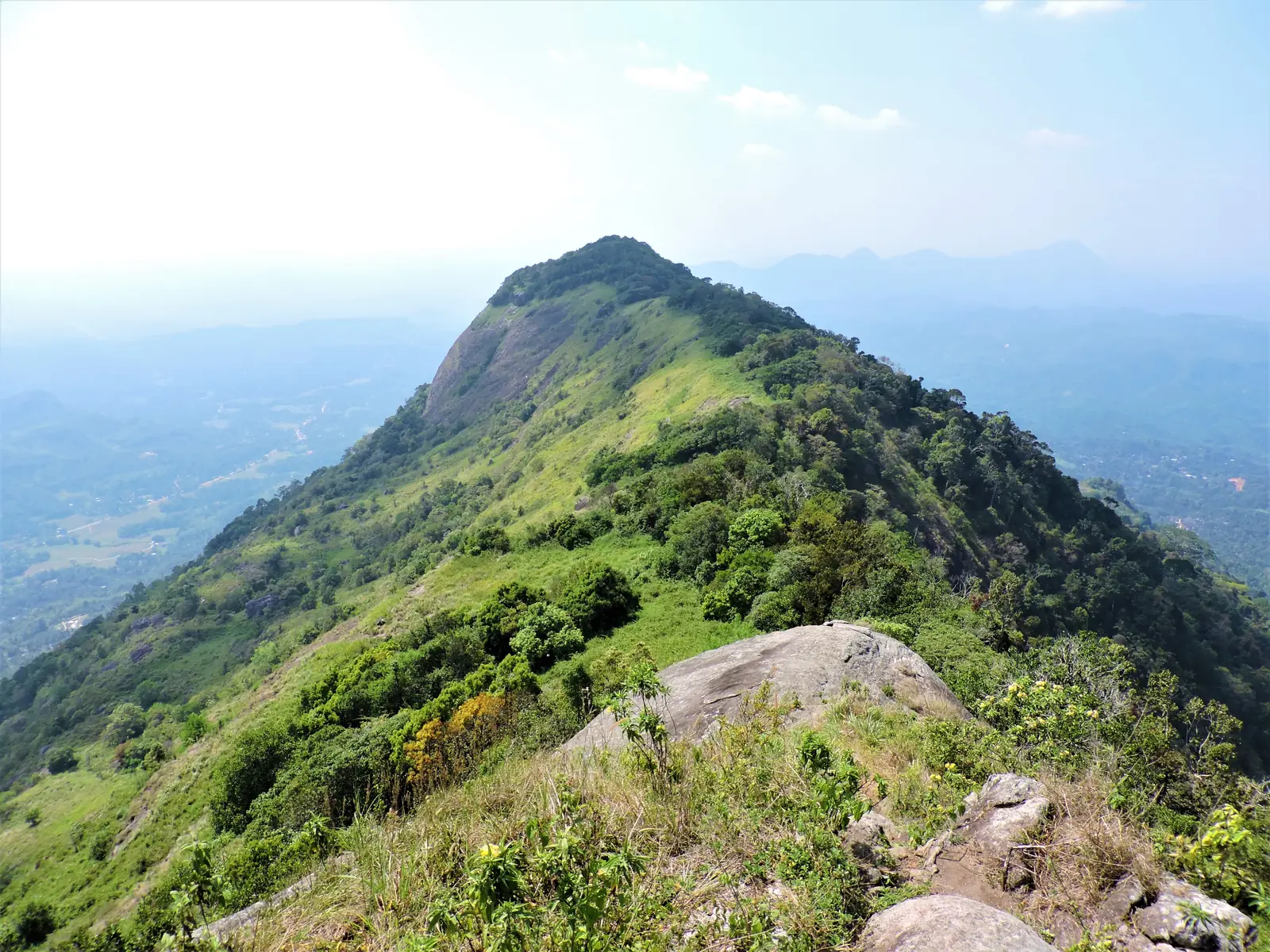
Alagalla Mountain
Central Province
Photo by Icaptures84 via Wikimedia Commons, licensed under CC BY-SA 4.0.
About Alagalla Mountain
Alagalla - the British called it the Potato Range for its knobbly profile - stands sentinel over the historic gap where road and rail squeeze from the lowlands into the Kandyan hills, and its 1,140-metre summit delivers a panorama out of all proportion to the climb. The classic trail starts near Pottapitiya or from the railway itself at Ihala Kotte station, climbing three to four hours through rubber, spice gardens, pine, and final rocky scrambles (fixed ropes on the steepest pitch) to a summit ridge where the view unrolls: Bible Rock's open book across the valley, the trains toiling up the incline below, Kandy's ranges one way and the plains dissolving toward Colombo the other. Kandyan kings used Alagalla as a watchtower against invaders marching up the gap - you will understand why. Weekday mornings you may have the whole mountain to yourself.
Top Activities
- ✓Summit hike via Pottapitiya or Ihala Kotte
- ✓Railway-incline and Bible Rock views
- ✓Village trails through spice gardens
- ✓Camping on the ridge (with guides)
- ✓Combine with Kadugannawa's railway museum
Nearby Attractions
Closest Places in This Guide
Straight-line distances; allow considerably longer by road, especially in the hills.
Travel Tips
Start by 6.30am - the summit clouds over by late morning.
The final rope-assisted pitch needs both hands; pack light.
A local guide from Pottapitiya keeps the forks honest.
Quick Info
Best Time
December to April; early starts
Weather
Warm below, breezy on the ridge; avoid the rock scramble in rain.
Estimated Daily Budget
7.2258°N, 80.4711°E
Open in Google Maps →Ready to Visit?
Add Alagalla Mountain to your trip and let AI create your personalised itinerary.